


 Verdi Twp., Lincoln Co., MN
Located from Lake Benton, MN – Jct. of Hwy. #75 & US Hwy. #14 – 2 ¼ Miles West on Hwy. #14 to the NE Corner of Tract #1A. From Elkton, SD (Skyview Junction) – Hwy. #13/486th Ave & US Hwy. #14 – 7 ½ Miles E. on US Hwy. #14 to the NW Corner of Tract #1A.
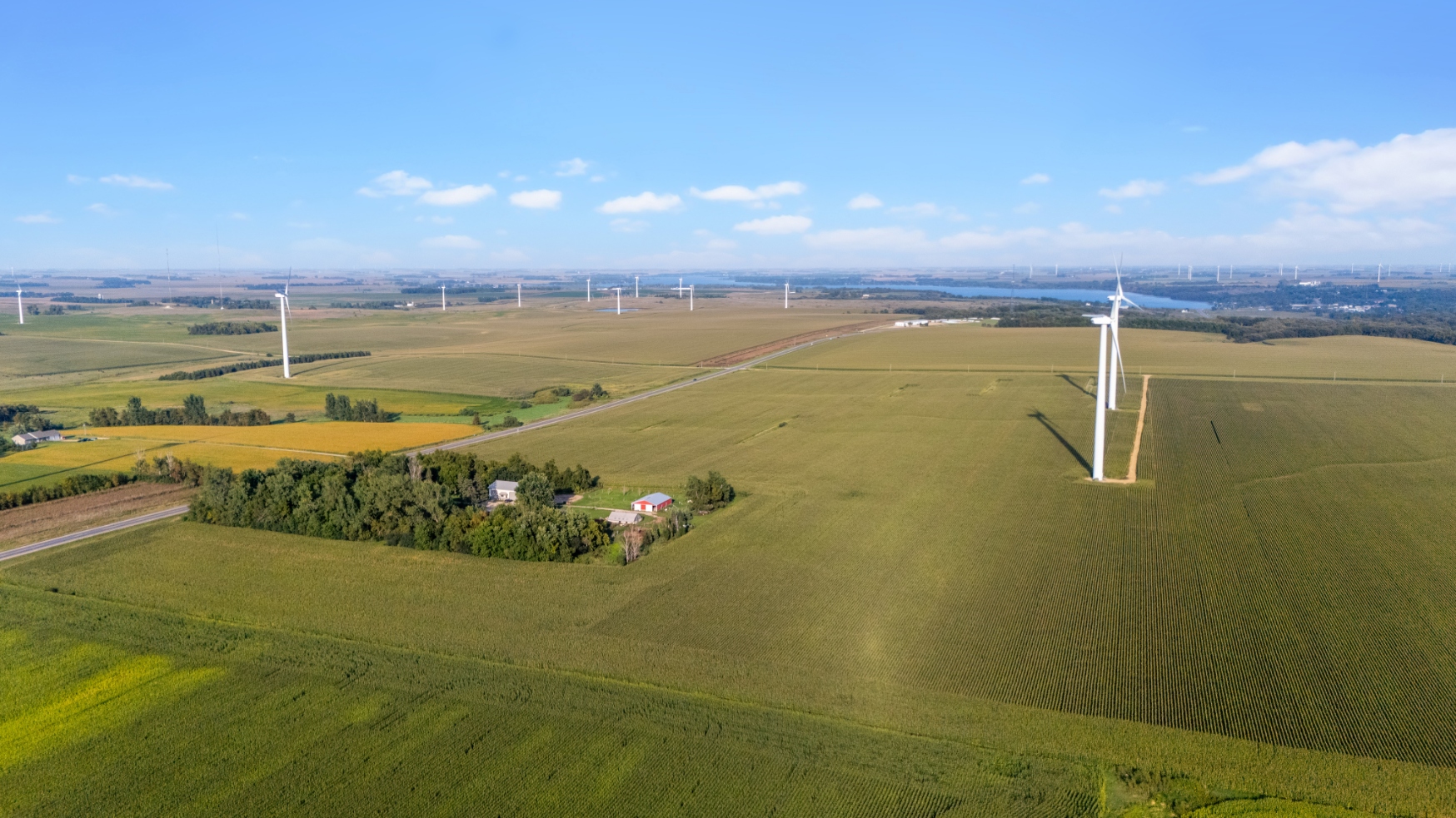
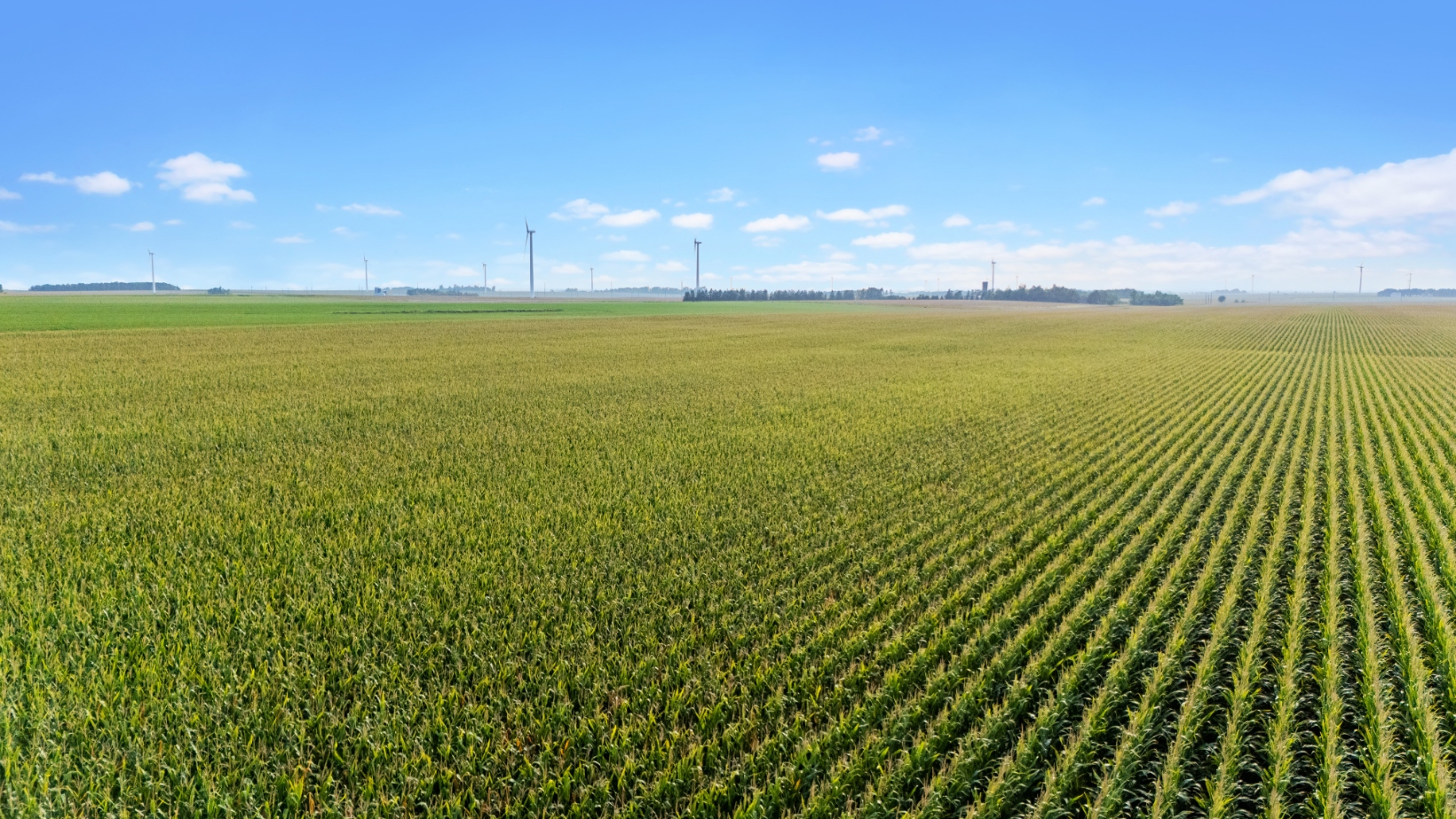
AUCTIONEER’S NOTE: This auction awards the opportunity to purchase 2 extremely choice parcels of Lincoln County, MN Land with excellent location. These 2 farms will be offered individually or as a combined unit. Both of these farms have extremely high percentages tillable and superb soil ratings! If you are in the market for a parcel or parcels of high caliber Lincoln County, MN Land to add to an area row crop operation or investment, then make plans to inspect these properties & be in attendance at this auction!
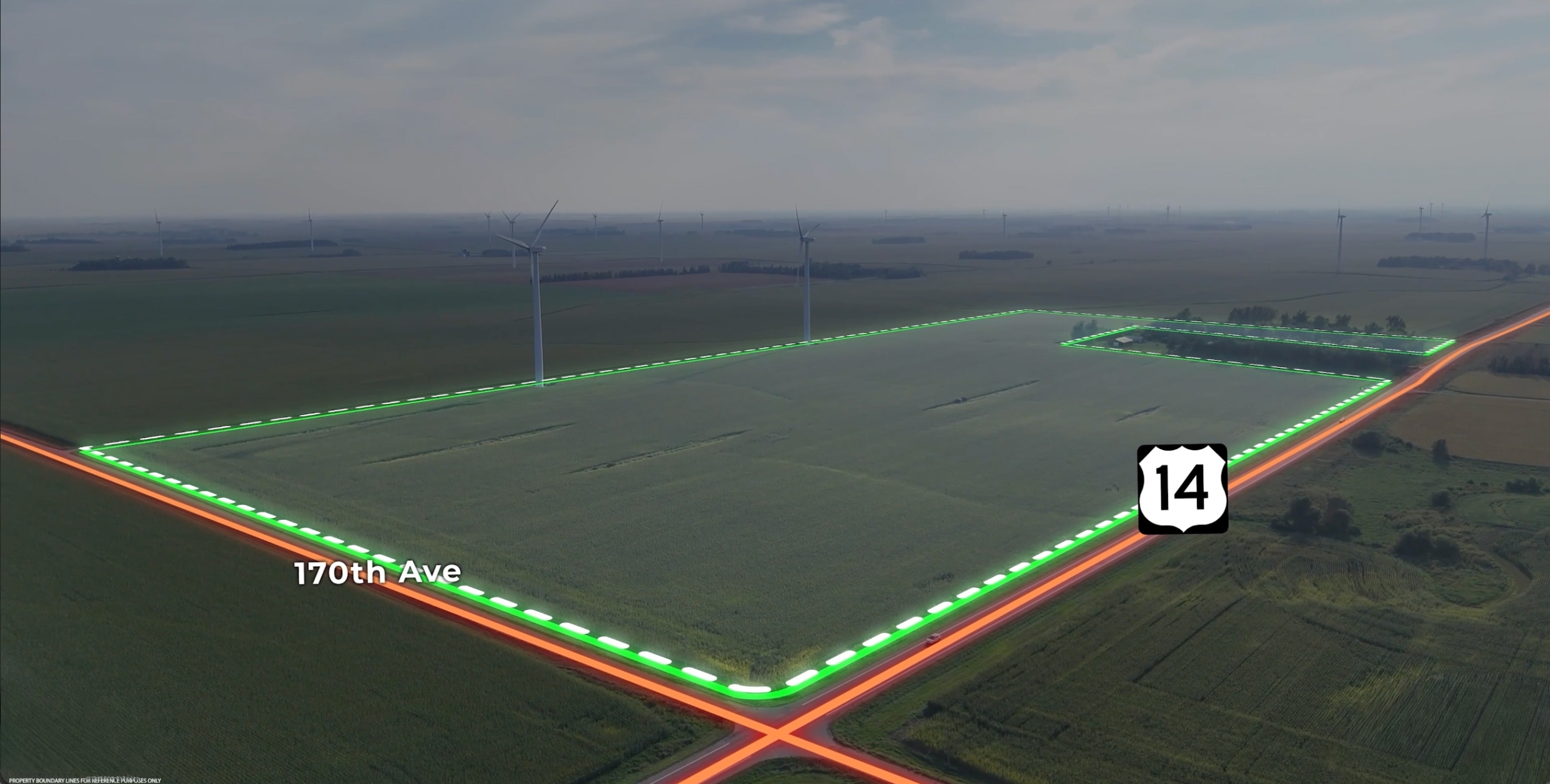
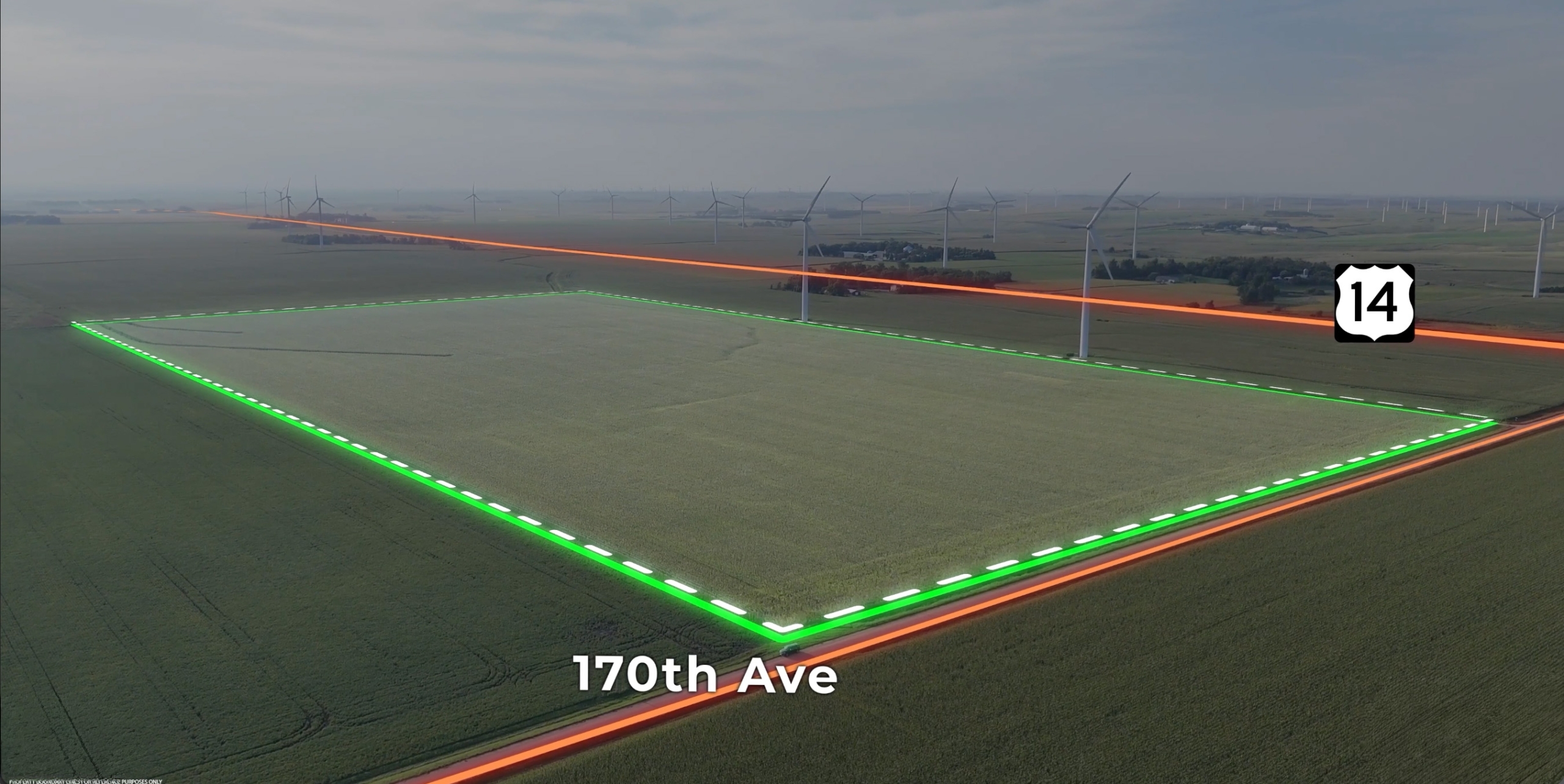

TRACT #1A: The North +/-73.62 Surveyed Acres – Legal Desc.: The N. ½ of the NE ¼ Exc. Acreage Site in Sec. 12, T. 109N, R. 46W, Verdi Twp., Lincoln County, MN
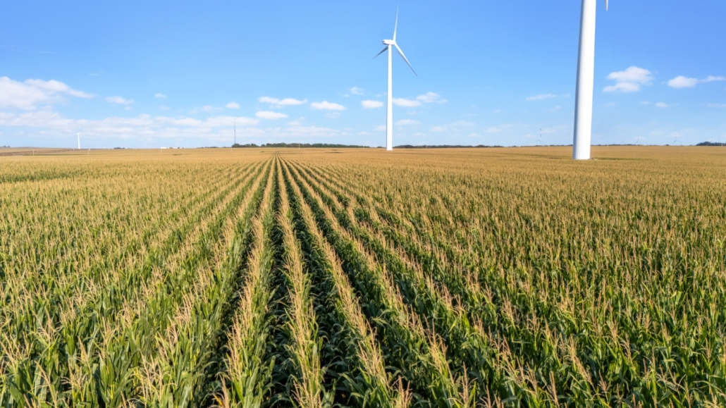
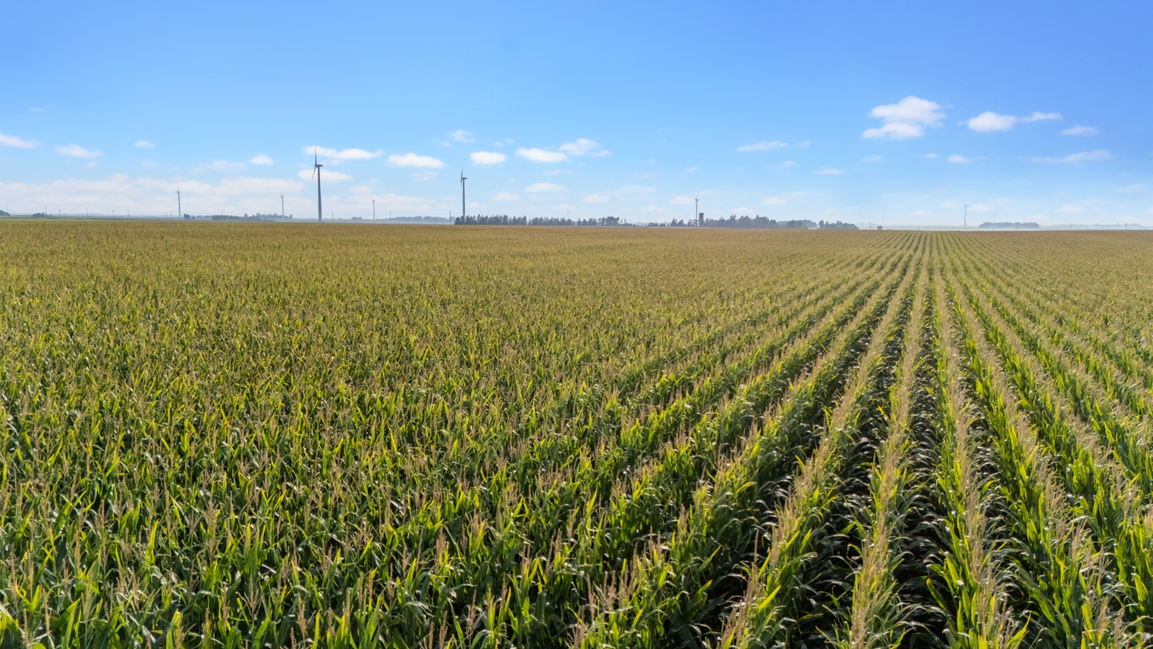
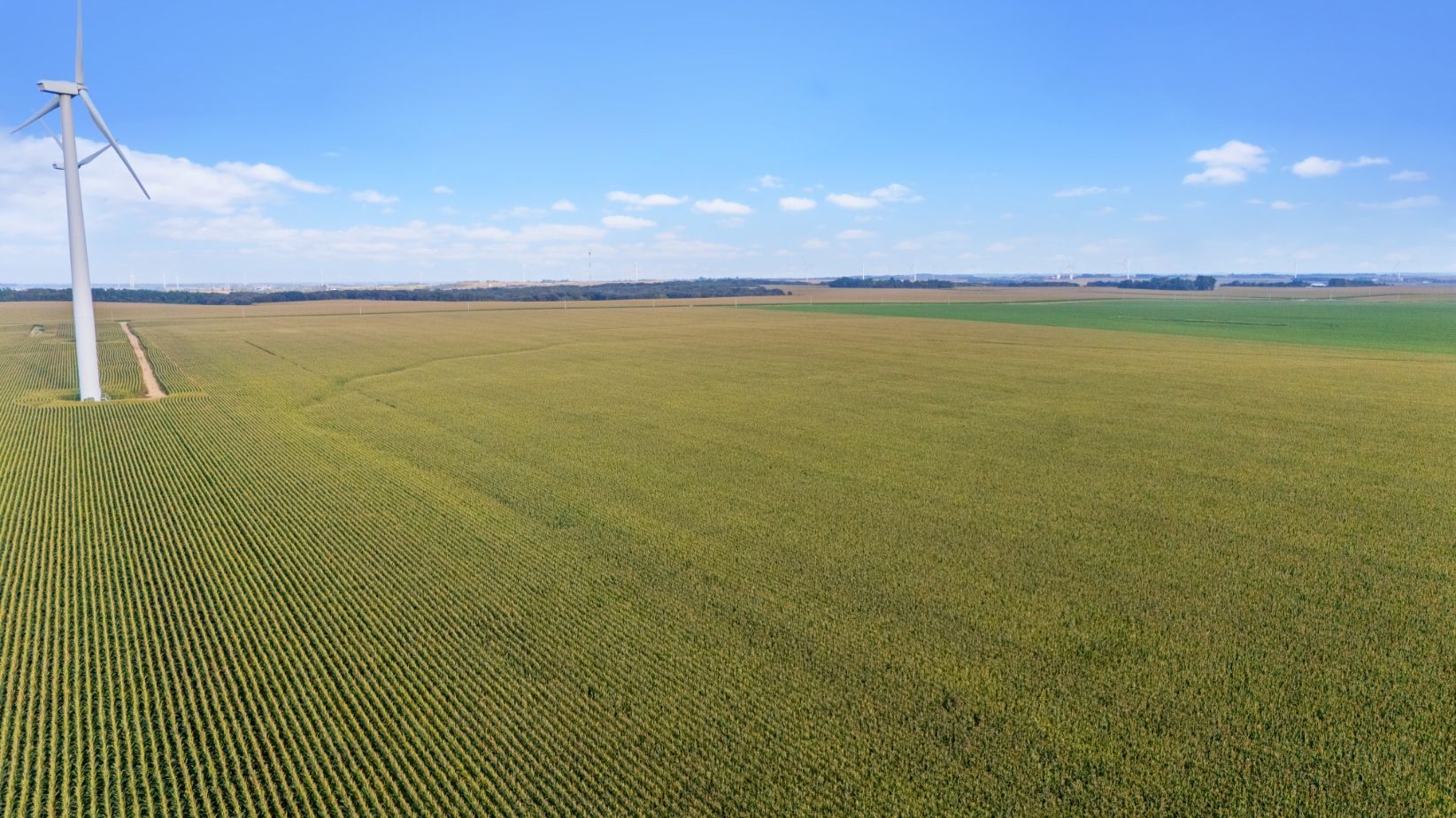
Tract #1A has a high percentage tillable with +/-68.00 Acres of cropland with a 42.86 acre corn base with a 151 Bu. PLC yield & a 23.34 acre soybean base with a 40 Bu. PLC yield with the non-tillable acres primarily comprised of the 2 tower sites, ditches & roads. According to information from Surety Agridata Inc., this parcel contains a 95.0 weighted average productivity index consisting of 100% Class I & II soils. According to county assessors information, this property has a CER of a 60.80. This parcel has some existing drain tile, copies of tile maps are available. There is an existing wind tower easement on this property through Minndakota Wind, LLC (Avangrid) which has been extended to 2042 with a possibility of another additional 5 year extension to 2047. The previous income for the 2 towers on the property since 2020 has ranged from $7,602.39 up to $11,577.46 with a base payment of $2,750 per tower for the 2 towers & a per megawatt payment calculated to determine the total annual payments (copies of Royalty Statements Available upon request). If these parcels are sold separately, all future payments for the existing wind towers will be allocated to Tract #1A. The 2025 RE taxes on this parcel are $2,308.00. The acres on Tract #1A may be adjusted slightly in accordance with a final survey.
TRACT #1B: The South +/-80.80 Surveyed Acres – Legal Desc.: The S. ½ of the NE ¼ of Sec. 12, T. 109N, R. 46W, Verdi Twp., Lincoln County, MN
Tract #1B is an inside, virtually all tillable parcel of land with superb soils. According to FSA information this farm contains +/-80.01 acres of cropland with a 50.44 acre corn base with a 151 Bu. PLC yield & a 27.46 acre soybean base with a 40 Bu. PLC yield. According to information from Surety Agridata Inc., this parcel is indicated to have a 94.5 weighted average productivity index consisting of 100% Class I & II soils. According to county assessors information, this property has a CER of a 60.32. The 2025 RE taxes on this property are $2,524.00. This parcel is part of the original Minndakota Wind lease on the NE ¼. As both towers are situated on Tract #1A, all future wind payments will be attributed to Tr. #1A if sold separately.
UNIT INFORMATION: This land as a whole has been previously enhanced with the instillation with 10”, 8”, 6”, & 5” drain tile. Copies of tile maps are available upon request. Additionally, certified wetland determinations are available upon request. According to Surety Agridata Inc., this parcel overall has a weighted average productivity index of a 94.7 & FSA information indicates a total of 148.01 cropland acres total on the combined unity. The sale of this land is especially noteworthy as this land has been in the same family since the 1940’s, making this a once in a lifetime opportunity to purchase these farms!
NE ¼ of Sec. 12 Exc. Acreage Site, T. 109N, R. 46W, Verdi Twp., Lincoln County, MN
A 10% non-refundable downpayment on the day of the sale and the balance on or before December 12, 2025 with full possession for the 2026 crop year. Possession subsequent to the harvest of the 2025 standing crops and the tenant’s rights under the 2025 farm lease. The sellers will retain 100% of the 2025 rents and wind tower payments. Marketable Title will be conveyed and at the sellers option title insurance will be utilized with the cost to be split 50-50 between buyer & seller or an abstract of title will be continued to date & will be provided to the buyer for examination prior to closing. Attorney’s closing fees will be paid by the sellers. All of the RE taxes payable in 2025 on this property will be “paid in full” by the sellers, with the buyer to be responsible for all of the RE taxes payable in 2026. The sellers have no knowledge of any wells on the premises. The sellers do not warranty or guarantee that existing fences lie on the true boundary and any new fencing, if any, will be the responsibility of the purchaser pursuant to MN statutes. FSA cropland acres, yields, bases & other information are estimated and subject to County Committee approval. These properties have been surveyed to establish the location of the boundaries between both parcels and to ascertain the total acres in these farms in accordance with recent surveys by Bueltel-Moseng Land Surveying, Inc., with the acres understood to be “more or less”. These properties are sold in “AS IS” CONDITION and subject to any existing easements, restrictions, reservations or highways of record if any, as well as any or all Lincoln Co., MN Zoning Ordinances. Information contained herein is deemed to be correct, but is not guaranteed. The RE licensees/auctioneers in this transaction stipulate that they are acting as agents for the sellers. Sold subject to confirmation of the owners.
WILLIAM & DEBRA SCHAEFER AND DONNA WENDORFF
CHUCK SUTTON – Auctioneer – #59-26 & Land Broker – Sioux Falls, SD – Ph. 605-336-6315 JARED SUTTON CAI – Auctioneer – #59-72 & RE Salesman – Flandreau, SD – Ph. 605-864-8527 DAN SUTTON – Listing Agent – RE Salesman – Flandreau, SD – Ph. 605-864-1477 BURLAGE-PETERSON – Auctioneers & Realtors – Brookings, SD – ph. 605-692-7102

 Apartment Complex Real Estate Auction, Brookings SD
Scroll to top
Apartment Complex Real Estate Auction, Brookings SD
Scroll to top